Fusion Tables(試験運用)とは、Google ドライブのページによりますと以下のとおり。
Take advantage of your stored data to combine, co-edit, visually represent, and share it with other data on the web. All the data you organize is automatically saved and stored in Google Drive.
Even though it was a test operation, it appeared in 2009, so it was quite a while ago.
Since it seems to be possible to link data with Google Maps, I wanted to play with it a bit, so I made a “French provinces I’ve been to or passed through”.
I just pulled the public data from here and improved it a bit.
France boundary data – Fusion Tables Help http://support.google.com/fusiontables/answer/2614837?hl=en
There were 8 prefectures in mainland France and 2 in Corsica that I had not visited.
I once made a map of the French provinces I’ve been to or passed through, but this one is simpler and more clever.
You can save the results to Google Drive or easily embed them in your website by doing the following

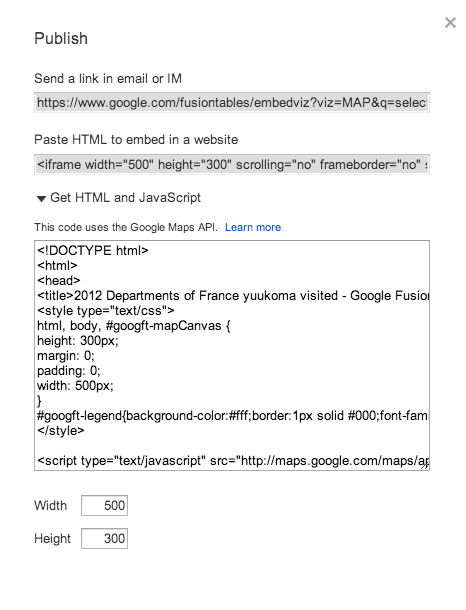
If you are familiar with Google Map API, you can easily apply it.
まだあまり使いこなせていませんが、他にもpublic dataがそこそこあって、データをマージさせたり、そのデータをビジュアル化させたりできるようなので、他にもいろいろなことして遊んでみようと思います。
とりあえず「今まで行った or 通過した地図」をヨーロッパ全土に広げてみようかな。